This summer has been one of the hottest in decades in Jilin Province, China, and several counties are facing the complete loss of their harvests.
Currently, Changling, Nongan, Gongzhuling and 10 other agricultural counties in Jilin are facing a severe drought. The severity of the drought is comparable to that in 1951.
A villager Ms. Lee from Wanglong village, Huajia Township, Nongan County, Changhun City, told Epoch Times: “The drought is very bad. All the corn leaves have turned yellow. Corns are not fully grown, only their tips are seen with barely any kernels.”
Since July 1 this year, the rainfall in Jilin Province totaled only 4.4 inches, which is about 48 percent less compared to the same period from previous years. This year had the second lowest rainfall in history; the least amount since 1951.
Over 14 million acres of farmland are affected.
Government data indicates the drought has impacted more than 1.3 million acres of farmland in the major agricultural areas of Jilin with no improvements in sight. According to the weather forecast, the average rainfall could be as low as a third of an inch per day.
Ms. Lee, a villager from Wanglong village said: “Even the water level of our own well is slowly dropping. It is only enough for domestic use. Our farmland has not been irrigated for over a month.”
Mr. Sun from Zhen-Chai village, Nongan County said that all their cucumber plants have perished from the drought.
Chinese media has reported two-thirds of the corn stalks have withered in some towns while others have completely perished.
Local governments have not taken any measure to tackle this problem and villagers are on their own. A staff member at Jilin Grain Bureau only briefly told Epoch Times that the situation was “unclear” and then hung up the phone.
Other Provinces Impacted
During the summer, a total of 12 provinces, including Shandong, Henan, Shaanxi Anhui, Hubei, Gangsu, and Xinjiang, have been affected by the drought. Over 14 million acres of farmland are affected.
Henan Province, for example, is witnessing the worst drought in the last 63 year with 740,000 people facing a temporary shortage of drinking water. In Shandong Province the cost of the lost harvest is reaching $630 million.
All these statistics put into question the recently announced food exports to Russia. After Russia announced it would stop importing food from Europe, the United States, and Australia, China immediately started building a warehouse on the Russian boarder to facilitate customs clearance for fruit going into Russia. More
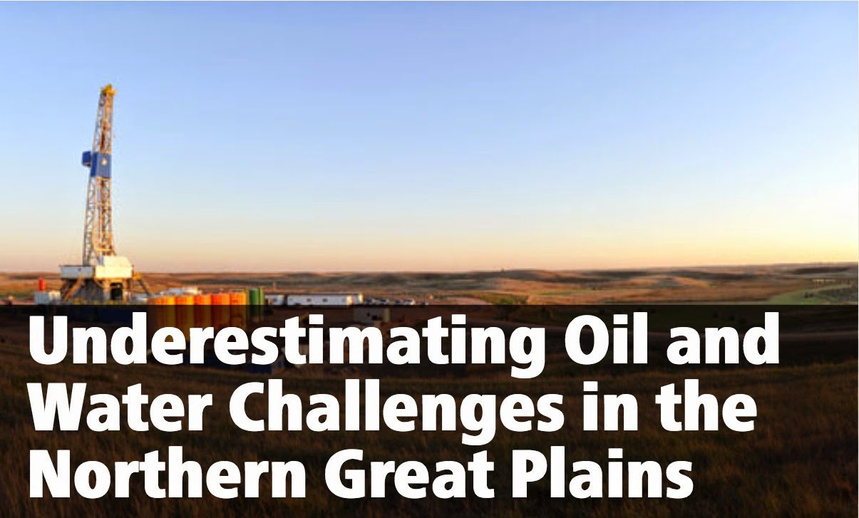
The Northern Great Plains has become the epicenter of new oil development in the United States. New production techniques have set off an oil boom there reminiscent of the chaotic conditions over a century ago when the prospect of black gold drew developers to Texas.
Water impacts were not remotely a consideration back then. But now, unprecedented levels of drilling in this huge oil basin require the implementation of careful water management practices to protect regional resources.
Drilling takes place throughout the Great Plains’ Williston oil basin, home to the Bakken, Three Forks, and Tyler formations, reaching into the U.S. states of North Dakota, South Dakota,1 and Montana as well as Canada’s provinces of Saskatchewan and Alberta. With an estimated 7.4 billion barrels of technically recoverable oil in the United States (plus an additional 1.6 billion barrels in Canada), the Williston basin is the largest continuous oil accumulation in the country.
It is also one of the world’s most rapidly and densely developed oil plays with about 8,000 still-active wells drilled between 2006 and 2014. The United States Geological Survey (USGS) estimates that five times that number will be needed to access the total technically recoverable oil. But plans to continue producing at this rate will pose severe oil-water risks in the area.
The region’s geology and history convey unique water challenges, quite different from those in other U.S. shale formations. The sheer number of wells needed to produce the Williston creates a huge demand on freshwater for drilling, hydraulic fracturing, and maintenance. Along with oil, produced water (wastewater produced as a byproduct during oil production) is brought to the surface through these wells. Produced water yields are correlated to oil yields, so as the Williston basin’s oil production increases, produced water quantities and the associated contamination risks and disposal needs will accumulate. Further complicating the freshwater quantity demands and wastewater contamination concerns, a mosaic of state, national, and tribal borders provides potential for irregular data reporting, insufficient regulatory oversight, inconsistent rules, and inadequate contamination cleanup.
If the Williston basin is going to help supply America’s oil needs over the long term, the Northern Great Plains’ oil-water challenges must be adequately controlled and safely managed.
Continuous, Complex Geology
The Williston’s shale is relatively easy to navigate. Overlapping formations allow oil companies to extract the oil with great speed and success.
The Bakken, while it has limited amounts of conventionally pooled oil, is almost completely an unconventional shale oil play. It is comprised of three informal layers: the upper, middle,and lower. Directly beneath the Bakken lies the Three Forks formation.2 Three Forks 1, the shallowest of the formation’s four main layers, has been produced in conjunction with the Bakken for many years. Recently, however, oil companies have begun to explore some of the deeper layers, allowing them to produce at multiple depths from the same plot of land, gaining access to more oil without acquiring more land. The Tyler formation, which is much shallower than the Bakken and Three Forks formations, is located farther south, and its unconventional oil potential is just beginning to be explored.
The Bakken formation was first identified in the early 1950s, though production was initially quite slow. That changed with the advent of hydraulic fracturing—the process of injecting a high-pressure slurry of chemicals, water, and propping agents to break apart shale and allow hydrocarbons to flow out of rock formations. Innovations in this technique transformed North Dakota’s oil operations.
Since 2006, oil production has expanded exponentially into the Bakken, Three Forks, and Tyler formations along with other smaller, lesser-known formations in the area (see map). Recently, drilling horizontally to produce oil in the Tyler formation has begun though it is still uncertain if the Tyler formation will be able to transition from a somewhat successful conventional play (accessed by vertical drilling) into a strong continuous play, produced by replicating new techniques used in the Bakken.
Companies aim to further reduce the space between wells to maximize access to oils at different depths from the same acreage. Leases that had only one well before may now have up to eight. As seen in Kodiak Oil & Gas Corp’s, Continental Resources Inc.’s, and other companies’ plans, there could be 14–34 wells per 1,280 acre lease.5 Wells are drilled and fracked more quickly and more cheaply as technology advances allowing companies to expand and increase their water demands rapidly.
The drilling process demands some water, but the hydraulic fracturing process and the water used to clean the well over its lifetime account for most of the water consumed during oil extraction. A single well fracking in the Williston averages 2 million gallons of water. Refracking wells two to three times, which is now common practice in the Williston, demands proportionately more freshwater than one-time fracking seen in other basins. And while some of the water used to clean wells can be reused as the base fluid for new fracking projects, new freshwater is required for each maintenance flush.
Getting to the Water Sources
With so much freshwater required to boost oil production, the question is: Where will the water come from? A range of resources can be found in the Northern Great Plains’ geology, including bedrock aquifers at many depths, glacial aquifers, the Missouri River winding through Montana and North Dakota, and Lake Sakakawea, a reservoir on the Missouri. These water resources vary markedly, and their characteristics must be used to determine how much water and which water the states can afford to permit oil companies to acquire, directly and indirectly.6
Making the situation more complicated, while the area may have ample water supplies, many rural citizens do not have secure access to them. The region currently struggles with fresh groundwater scarcity, low precipitation, minimal water infrastructure making transporting water extremely difficult, and federal restrictions regarding the use of the Missouri River and Lake Sakakawea as surface water sources.
Overdrawn Aquifers
Confined bedrock aquifers of varying water quality underlie the Williston basin, some of which are artesian aquifers that flow to the surface without the need for electrical pumps, a boon in remote locations that must be protected.
The slightly saline Fox Hills–Hell Creek aquifer (noted with diagonal orange lines on the map) is the only groundwater source capable of consistently producing large amounts of freshwater. As a result, it is overdrawn. Although rarely a drinking water source because of its relatively high concentration of total dissolved solids, (2,500 milligrams per liter), it is a major source for industrial, livestock, and residential use.7
Overuse has caused rapid long-term reduction in aquifer pressure by 1 to 2 feet per year. As a result, some of the artesian wells drawing from the Fox Hills–Hell Creek aquifer have stopped flowing and more will dry up in the future. Using this aquifer solely for domestic and livestock purposes and forcing industry to find other sources of water has been discussed, but stronger action may be needed.
Difficult-to-Manage Aquifers
Glacial aquifers, formed as glaciers melted and receded leaving permeable sediment behind, can be found in drainage system patterns throughout North Dakota and Montana. These aquifers, usually less than a few hundred feet deep, can be much more productive than bedrock aquifers, often with lower total dissolved solids concentrations. Their high flow rates mean water spends shorter times within the aquifer dissolving and accumulating salts and minerals. Thus, these aquifers often tend to be the only source of irrigation-quality groundwater in the area. High flow rates, however, lead to difficulty managing the resource, as discharge can happen quickly while recharge rates are variable and uncertain.
Tapping Lakes and Rivers
The most reliable sources of surface water in the area are the Missouri River and its reservoir, Lake Sakakawea. Much of the water currently used for hydraulic fracturing in North Dakota and Montana comes from the Missouri River.
Without depending on water withdrawal from lakes and rivers, it will be impossible to meet the upward trend of oil production without harming the Northern Great Plains’ aquifers and tributary streams. So, as industry demands rise, oil companies are pushing back on the U.S. Corps of Engineers’ (USCOE) 2010 moratorium that prevents lake-water access permits. North Dakota law makes the state water commission responsible for issuing permits for Lake Sakakawea water use, but the USCOE is the only power that can grant permission to access the lake for water diversion. The moratorium was put in place temporarily while the USCOE determined what price to charge for Missouri River water stored behind its dam. Over time, however, the moratorium has morphed into a 100,000 acre foot per year temporary permitting limit, with no storage fee applicable until the USCOE approves a water price.
The oil industry would benefit from permanent access to Lake Sakakawea at little or no cost, but such an arrangement would not be durable. The millions of gallons each well uses over its lifetime would necessitate many new infrastructure investments to transport Lake Sakakawea’s water throughout the basin. These oil-water commitments would also impact local residents’ future higher-priority needs.
Oil companies in eastern Montana do not currently have access to Lake Sakakawea, instead depending on the Missouri River as a surface water resource, even though many of its tributaries are over-appropriated. The Yellowstone River, which cuts through parts of the Williston basin, is also a potential water source for the oil industry; however, some stretches are closed off to new appropriations, and temporal variation in flow causes the river to be over-appropriated at times. While finding cheap and accessible water may be difficult in Montana, the oil industry’s surface water (and groundwater) needs there pale in comparison to the struggles facing North Dakota, where the majority of drilling occurs.
The Salt Problem
All this is particularly problematic because the Northern Great Plains contains large volumes of highly saline water. This water—up to ten times the salinity of ocean water—is housed in the same rocks that trap oil in the Williston basin. When pumped out with the oil, this produced water must be treated as waste.
Once production begins, a well operator begins pumping out the fluid used to frack the well along with highly saline produced water and oil. This continues through the well’s lifetime—with volumes of these three fluids changing dramatically over the lifetime of the well, the amount of fracking fluid recovered at the surface dropping off dramatically in the days following fracking, and the ratio of produced water to oil increasing as the well ages. Produced water from the Bakken formation also contains toxic metals and radioactive substances and can measure up to 300,000 milligrams per liter of total dissolved solids.
Most of the produced water in the Williston is transported to Class II injection wells (see blue dots on map) for disposal. Injecting this water deep underground can prevent ground and surface water contamination, if done properly. Proper disposal is important because spills and contamination in the Williston basin are far more damaging than mishandlings of less saline produced waters from other U.S. basins.
One possibility for contamination in the Northern Great Plains arises during produced water transport—by truck and underground pipeline—to its injection site. With trucks and pipelines covering long distances between the producing well and the Class II injection well, the potential to spill oil and produced water arises. Truck spills may be obvious, but pipeline spills may go unnoticed as any evidence remains underground for some time.
Contamination of water resources can also be caused by spilling oil or produced water through operator error, illegal dumping, well blowouts, and flooding (sometimes caused by ice jams or heavy rains). Produced water spills are a far greater concern than oil spills because they spread much more rapidly and salts disperse quickly through surface or ground water. Spills’ boundaries are rarely well defined and oil and produced water can saturate any permeable soil near the spill, including by migrating beyond state or reservation borders.
Glacial aquifers in particular, with their fast recharge rates, can be quickly contaminated by surface spills, especially from produced water. Successful management of glacial aquifers is vital to protect one of the Williston’s only sources of high quality groundwater.
The Williston basin region has experienced sizeable spills since the oil industry boomed in the mid-2000s. North Dakota’s largest and most damaging saltwater spill occurred in 2006 when a Zenergy pipeline failed, releasing more than 1 million gallons of saltwater into Charbonneau Creek (a Yellowstone River tributary). The pipeline didn’t have a monitoring system to record the pressure drop or the differential between input and output quantity that would have quickly notified the company of the leak. Eight years later, Zenergy is still remediating, and efforts are expected to continue into the future.8
Problems also stem from practices long past. The Northern Great Plains is just now seeing the effects of contamination from oil production that began over fifty years ago. According to a USGS report, the city of Poplar in the Fort Peck Reservation has never been able to pinpoint the precise source(s) of contamination on its territory (beyond linking it to oil field contamination) that has damaged upwards of 37 billion gallons of water in its shallow aquifers. Three thousand residents depend on these aquifers as their sole sources of water. The EPA reached an agreementwith the three oil companies they deemed responsible, and these companies must now monitor Poplar’s public water supply monthly, provide treatment or an alternate water source for any degraded water quality, and cover the city’s $320,000 cost to identify safer water sources and relocate public water infrastructure. It has taken a half-century since initial contamination for stakeholders to experience its consequences because of the slow speed at which contamination travels in the subsurface. This contamination acts as a warning that the negative effects of oil production may take many years to come to light.
Beyond contamination, the high concentrations of salt in Williston produced water routinely builds up on equipment, damaging it and restricting oil flow. To prevent this salt buildup, oil companies use maintenance water—freshwater treated with biocides—to flush wells. Over a well’s thirty-year lifetime, almost 9 million gallonsof additional water may be used to remove the oil-restricting salt buildup.
Oil-production-related water contamination plagues all oil fields but, because of the Williston basin’s high salt content, water spills in eastern Montana and western North Dakota are especially dangerous to the environment and the people dependent on local water for their drinking, domestic, irrigation, and livestock water needs. Comprehensive regulations could help mitigate the risks, but protecting water resources in this area will be an ongoing challenge in the Williston basin.
Reporting Issues and Regulatory Confusion
Data on oil production in the Williston basin are extensive, but underreporting is a growing concern. Some counties do not report any produced water despite highly productive oil wells, and it remains unclear as to whether the Fort Peck Reservation reports its produced water. There are also loopholes in reporting spills and contamination events. Accuracy varies depending on the regulator and extent of regulatory oversight.9
A new online tool helps navigate oilfield-related spills in North Dakota, of which, until now, the public was rarely informed. But companies can report “no” water spilled when the actual amount discharged is unknown. Wells can be listed as confidentialfor up to six months after drilling begins, reporting no spill information to the public except in rare cases. Montana does not even maintain an electronic database, and the state government records spill information only on paper, making spill and contamination research more difficult. This means that rural residents do not have easy access to the history of contamination and the presence of spills in the area in which they live.
LONDON – The proclamation of a new Cold War, following Russia’s annexation of Crimea, turned out to be alarmist and premature. However, it reflected the anxiety of today’s decision-makers in the face of a crumbling global order.
With emerging economies far from committed to established norms in international relations, many governments and multinational companies are feeling vulnerable about relying on others for vital resources – the European Union’s dependence on Russian gas being a case in point.
Competition for scarce resources is sorely testing our assumptions about global governance and cooperation, at a time when collective leadership is becoming ever more necessary. But even in the absence of overarching global legal frameworks, it is possible to maintain a sense of common security if the terms of resource investments are founded on long-term political understanding and commercial relationships, rather than short-term competition.
The stakes are high. Resource scarcity is closely linked to political risks. Consider, for example, the drought that decimated Russia’s 2010 wheat harvest. In response, Russia imposed export restrictions to shore up its domestic supplies, sending food prices soaring in its main export markets, especially Egypt. This in turn helped spark the political uprisings that spread rapidly across North Africa and the Middle East. Climate change is expected to trigger many more such chains of events.
One test case for such cooperation is the potentially explosive issue of the Nile Delta’s water resources. Britain’s colonial-era treaty has, since 1929, given Egypt a veto over any upstream river project that might affect the country’s water supply
One test case for such cooperation is the potentially explosive issue of the Nile Delta’s water resources. Britain’s colonial-era treaty has, since 1929, given Egypt a veto over any upstream river project that might affect the country’s water supply. Several Nile Basin countries, including Sudan and Ethiopia, have now ratified a new, Nile River Basin Cooperative Framework agreement, which Egypt has yet to sign. Given Egypt’s concerns about potential water shortages arising from Ethiopia’s new upstream hydropower plants, its assent is far from assured.
Indeed, in Egypt’s febrile political atmosphere, its newly elected president, General Abdul Fattah el-Sisi, may be tempted to escalate the threat of military action in response to Ethiopia’s hydropower projects. Such a move would send shockwaves through a region already reeling from conflict in South Sudan, Syria, Iraq, and Lebanon.
To avoid another dangerous political-environmental chain reaction, nudging all sides toward agreement will require achieving mutual recognition of resource concerns. Ethiopia must credibly guarantee the supply of water downstream, for example, by establishing a water-replenishment rate at its dam reservoirs that does not threaten the onward flow of water to Egypt. At the same time, Egypt, while retaining the fundamental right to protect its water supply, must recognize the interests of its upstream neighbors and be ready to negotiate in good faith a new Nile Basin treaty.
Multinational companies and sovereign investors like China, which have financed hydropower projects upstream, will come under increasing pressure to adopt a position. They, too, can play a positive role by considering the cross-border investments that will address critical interdependencies, like Egypt’s wasteful agricultural irrigation practices.
Similar resource-related tensions are surfacing in other parts of the world. Water stress and food security threaten to constrain India’s economic promise, as increasing coal-powered electricity generation diverts water resources away from agriculture. The political risks of investing in Nigeria’s agriculture sector are also rising as a result of the country’s demographic explosion, high inflation, weak rule of law, and insecure land rights, with wider political consequences.
These resource strains are aggravated by foreign investments that seek to meet developed-country consumers’ voracious demand for resources without attention to their impact on sustainability in the host countries. This virtual outsourcing of the industrialized world’s environmental impacts, apart from being hypocritical, is no basis for building a strategy for global environmental sustainability.
Instead, the world needs to invest in sustainable agriculture, renewable energy, and green infrastructure. To be sure, the most promising efforts by leading multinationals today must confront entrenched subsidies and vested political interests. Unless the necessary policy frameworks are put in place green investment initiatives will continue to struggle to achieve a meaningful scale. Moreover, developed and developing countries seem unable even to agree on a fair division of environmental responsibilities, even though they have become increasingly interdependent in trade, investment, and the supply of natural resources.
These difficulties should not stop us from trying. The Earth Security Initiative is working with the BMW Foundation to develop global roundtables on resource security over a two-year period, starting in Hangzhou, China, on July 17- 20. These high-level, informal meetings will bring together leaders from politics, business, and civil society in Europe and emerging economies in an effort to bridge just such differences.
We know what needs to be done, why it is important, and who must be involved to secure our planet’s long-term future. We must now address the equally vital question of how this will be achieved.
The world risks an “insurmountable” water crisis by 2040 without an immediate and significant overhaul of energy consumption and demand, a research team reported on Wednesday.
“There will be no water by 2040 if we keep doing what we're doing today,” said Professor Benjamin Sovacool of Denmark's Aarhus University, who co-authored two reports on the world's rapidly decreasing sources of freshwater.
Many troubling global trends could worsen these baseline projected shortages. According to the report, water resources around the world are “increasingly strained by economic development, population growth, and climate change.” The World Resources Institute estimates that in India, “water demand will outstrip supply by as much as 50 percent by 2030, a situation worsened further by the country's likely decline of available freshwater due to climate change,” the report states. “[P]ower demand could more than double in northern China, more than triple in India, and increase by almost three-quarters in Texas.”
“If we keep doing business as usual, we are facing an insurmountable water shortage — even if water was free, because it's not a matter of the price,” Sovacool said. “There's no time to waste. We need to act now.”
In addition to an expanding global population, economic development, and an increasing demand for energy, the report also finds that the generation of electricity is one of the biggest sources of water consumption throughout the world, using up more water than even the agricultural industry. Unlike less water-intensive alternative sources of energy like wind and solar systems, fossil fuel-powered and nuclear plants need enormous and continued water inputs to function, both for fueling thermal generators and cooling cycles.
“It's a huge problem that the electricity sector do not even realize how much water they actually consume,” Sovacool said. “And together with the fact that we do not have unlimited water resources, it could lead to a serious crisis if nobody acts on it soon.”
Unless water use is drastically minimized, the researchers found that widespread drought will affect between 30 and 40 percent of the planet by 2020, and another two decades after that will see a severe water shortage that would affect the entire planet. The demand for both energy and drinking water would combine to aggressively speed up drought, which in turn could exacerbate large-scale health risks and other global development problems.
“The policy and technology choices made to meet demand will have immense implications for water withdrawals and consumption, and may also have significant economic, human health, and development consequences,” the report states.
The research says that utilizing alternative energy sources like wind and solar systems is vital to mitigating water consumption enough to stave off the crisis. “Unsubsidized wind power costs… are currently lower than coal or nuclear and they are continuing to drop,” the report states. When faced with its worst drought in 2011, Texas got up to 18 of its electricity from wind power and was able to avoid the kind of rolling blackouts that plague parts of China, where existing water shortages prevent power plants from operating.
An equally important step would be to shutter “thirsty” fossil fuel facilities in areas that are already experiencing water shortages, like China and India, where carbon emissions can be significantly more impactful.
“[We] have to decide where we spend our water in the future,” Sovacool said. “Do we want to spend it on keeping the power plants going or as drinking water? We don't have enough water to do both.” More
JULY 30, 2014 Water scarcity may be the most underrated resource issue the world is facing today.
Seventy percent of world fresh water use is for irrigation.
Each day we drink nearly 4 liters of water, but it takes some 2,000 liters of water—500 times as much—to produce the food we consume.
1,000 tons of water is used to produce 1 ton of grain.
Between 1950 and 2000, the world’s irrigated area tripled to roughly 700 million acres. After several decades of rapid increase, however, the growth has slowed dramatically, expanding only 9 percent from 2000 to 2009. Given that governments are much more likely to report increases than decreases, the recent net growth may be even smaller.
The dramatic loss of momentum in irrigation expansion coupled with the depletion of underground water resources suggests that peak water may now be on our doorstep.
Today some 18 countries, containing half the world’s people, are overpumping their aquifers. Among these are the big three grain producers—China, India, and the United States.
Saudi Arabia is the first country to publicly predict how aquifer depletion will reduce its grain harvest. It will soon be totally dependent on imports from the world market or overseas farming projects for its grain.
While falling water tables are largely hidden, rivers that run dry or are reduced to a trickle before reaching the sea are highly visible. Among this group that has limited outflow during at least part of the year are the Colorado, the major river in the southwestern United States; the Yellow, the largest river in northern China; the Nile, the lifeline of Egypt; the Indus, which supplies most of Pakistan’s irrigation water; and the Ganges in India’s densely populated Gangetic basin.
Many smaller rivers and lakes have disappeared entirely as water demands have increased.
Overseas “land grabs” for farming are also water grabs. Among the prime targets for overseas land acquisitions are Ethiopia and the Sudans, which together occupy three-fourths of the Nile River Basin, adding to the competition with Egypt for the river’s water.
It is often said that future wars will more likely be fought over water than oil, but in reality the competition for water is taking place in world grain markets. The countries that are financially the strongest, not necessarily those that are militarily the strongest, will fare best in this competition.
Climate change is hydrological change. Higher global average temperatures will mean more droughts in some areas, more flooding in others, and less predictability overall.
Water scarcity may be the most underrated resource issue the world is facing today.
Seventy percent of world fresh water use is for irrigation.
Each day we drink nearly 4 liters of water, but it takes some 2,000 liters of water—500 times as much—to produce the food we consume.
1,000 tons of water is used to produce 1 ton of grain.
Between 1950 and 2000, the world’s irrigated area tripled to roughly 700 million acres. After several decades of rapid increase, however, the growth has slowed dramatically, expanding only 9 percent from 2000 to 2009. Given that governments are much more likely to report increases than decreases, the recent net growth may be even smaller.
The dramatic loss of momentum in irrigation expansion coupled with the depletion of underground water resources suggests that peak water may now be on our doorstep.
Today some 18 countries, containing half the world’s people, are overpumping their aquifers. Among these are the big three grain producers—China, India, and the United States.
Saudi Arabia is the first country to publicly predict how aquifer depletion will reduce its grain harvest. It will soon be totally dependent on imports from the world market or overseas farming projects for its grain.
While falling water tables are largely hidden, rivers that run dry or are reduced to a trickle before reaching the sea are highly visible. Among this group that has limited outflow during at least part of the year are the Colorado, the major river in the southwestern United States; the Yellow, the largest river in northern China; the Nile, the lifeline of Egypt; the Indus, which supplies most of Pakistan’s irrigation water; and the Ganges in India’s densely populated Gangetic basin.
Many smaller rivers and lakes have disappeared entirely as water demands have increased.
Overseas “land grabs” for farming are also water grabs. Among the prime targets for overseas land acquisitions are Ethiopia and the Sudans, which together occupy three-fourths of the Nile River Basin, adding to the competition with Egypt for the river’s water.
It is often said that future wars will more likely be fought over water than oil, but in reality the competition for water is taking place in world grain markets. The countries that are financially the strongest, not necessarily those that are militarily the strongest, will fare best in this competition.
Climate change is hydrological change. Higher global average temperatures will mean more droughts in some areas, more flooding in others, and less predictability overall.
This visualization shows how satellite data and NASA models are being applied to study the hydrology of the Nile basin. The Tropical Rainfall Measurement Mission (TRMM) Multisensor Precipitation AnalysisfTMPA) provides three-hourly estimates of rainfall rate across much of the globe.
Here we see the seasonal cycle of monthly precipitation derived from TMPA for Africa, including the Nile Basin. The annual migration of the Intertropical Convergence Zone (ITCZ) from the Nile Equatorial Lakes region around Lake Victoria, source of the White Nile, northward into Sudan and the highlands of Ethiopia, headwaters of the Blue Nile, and back is evident in the seasonal cycle in precipitation. This precipitation cycle drives flow through the Nile River system. The Nile basin, however, is intensely evaporative, and the majority of the water that falls as rain leaves the basin as evaporation rather than river flow—either from the humid headwaters regions or from large resen/oirs and irrigation developments in Egypt and Sudan.
The Atmosphere Land Exchange Inverse (ALEXI) evapotranspiration product, developed by USDA scientists, uses satellite data to map daily evapotranspiration across the entire Nile basin, providing unprecedented information on water consumption. The balance of rainfall and evapotranspi ration can be seen in seasonal patterns of soil moisture, as simulated by the NASA Nile Land Data Assimilation System (LDAS), which merges satellite information with a physically-based land surface model to simulate variability in soil moisture—a critical variable for rainfed agriculture and natural ecosystems. Finally, the twin satellites of the Gravity Recovery and Climate Experiment (GRACE) can be used to monitor variability in total water storage, including surface water, soil moisture, andgroundwater. The annual cycle in GRACE estimates of water storage anomalies clearly shows the seasonal movement of water storage due to precipitation patterns and the movement of surface waters from headwaters regions into the wetlands of South Sudan and the resen/oirs of the lower Nile basin.
The Nile is the longest river in the world and its basin is shared by 11 countries. Reliable, spatially distributed estimates of hydrologic storage and fluxes can provide critical information for water managers contending with multiple resource demands, a variable and changing climate, and the risk of damaging floods and droughts. NASA observations and modeling systems offer unique capabilities to meet these information needs.
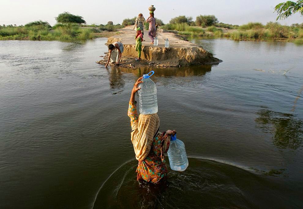
Nearly 30 percent of the world's cotton supply comes from India and Pakistan, much of that from the Indus River Valley. On average, about 737 billion gallons are withdrawn from the Indus River annually to grow cotton—enough to provide Delhi residents with household water for more than two years. (See a map of the region.)
Baseera Pakistan Aug 2010
“Pakistan's entire economy is driven by the textile industry,” said Michael Kugelman, a South Asia expert at the Woodrow Wilson International Center for Scholars. “The problem with Pakistan's economy is that most of the major industries use a ton of water—textiles, sugar, wheat—and there's a tremendous amount of water that's not only used, but wasted,” he added.
The same is true for India.
That impact is an important part of a complex water equation in countries already under strain from booming populations. More people means more demand for water to irrigate crops, cool machinery, and power cities. The Indus River, which begins in Indian-controlled Kashmir and flows through Pakistan on its way to the sea, is Pakistan's primary freshwater source—on which 90 percent of its agriculture depends—and a critical outlet of hydropower generation for both countries.
Downstream provinces are already feeling the strain, with some dried-out areas being abandoned by fishermen and farmers forced to move to cities. That increases competition between urban and rural communities for water. “In areas where you used to have raging rivers, you have, essentially, streams or even puddles and not much else,” said Kugelman.
In years past, the coastal districts that lost their shares of the Indus' flows have become “economically orphaned,” the poorest districts in the country, according to Pakistani water activist Mustafa Talpur. Because Pakistani civil society is weak, he says, corruption and deteriorating water distribution tend to go hand in hand.
In the port city of Karachi, which depends for its water on the Indus, water theft—in which public water is stolen from the pipes and sold from tankers in slums and around the city—may be a $500-million annual industry.
In the balance is the fate not only of people, but important aquatic species like the Indus River dolphin, which is now threatened to extinction by agricultural pollution and dams, among other pressures. Scientists estimate that fewer than 100 individuals remain.
Threat to Peace?
One of the potentially catastrophic consequences of the region's fragile water balance is the effect on political tensions.
In India, competition for water has a history of provoking conflict between communities. In Pakistan, water shortages have triggered food and energy crises that ignited riots and protests in some cities. Most troubling, Islamabad's diversions of water to upstream communities with ties to the government are inflaming sectarian loyalties and stoking unrest in the lower downstream region of Sindh.
But the issue also threatens the fragile peace that holds between the nations of India and Pakistan, two nuclear-armed rivals. Water has long been seen as a core strategic interest in the dispute over the Kashmir region, home to the Indus' headwaters. Since 1960, a delicate political accord called the Indus Waters Treaty has governed the sharing of the river's resources. But dwindling river flows will be harder to share as the populations in both countries grow and the per-capita water supply plummets.
Mountain glaciers in Kashmir play a central role in regulating the river's flows, acting as a natural water storage tank that freezes precipitation in winter and releases it as meltwater in the summer. The Indus is dependent on glacial melting for as much as half of its flow. So its fate is uniquely tied to the health of the Himalayas. In the short term, higher glacial melt is expected to bring more intense flooding, like last year's devastating deluge.
Both countries are also racing to complete large hydroelectric dams along their respective stretches of the Kashmir river system, elevating tensions. India's projects are of a size and scope that many Pakistanis fear could be used to disrupt their hydropower efforts, as well as the timing of the flows on which Pakistani crops rely.
“Many in Pakistan are worried that, being in control of upstream waters, India can easily run Pakistan dry either by diverting the flow of water by building storage dams or using up all the water through hydroelectric power schemes,” said Pakistani security analyst Rifaat Hussain.
For years, Pakistani politicians have claimed India is responsible for Pakistan's water troubles. More recently, militant groups have picked up their rhetoric. Hafiz Saeed, the founder of the Pakistani militant group allegedly responsible for the 2008 terror attack in Mumbai, even accused India of “water terrorism.”
Hope for the Future
In the past few months, however, the situation has improved, according to Kugelman. “We've been hearing nearly unprecedented statements from very high-level Pakistani officials who have essentially acknowledged that India is not stealing Pakistan's water, and that Pakistan's water problems are essentially a function of internal mismanagement issues,” he said. Militants are still griping, he said, “but not as shrilly.”
This may be because the two countries are cooperating on water and other issues better than before, and because militants are now focusing less on their archenemy in India and more on coalition forces in Afghanistan.
“But I imagine this is momentary,” said Kugelman. “The facts on the ground—the water constraints in both India and Pakistan—have not abated. They're both still very serious and getting worse.”
What's needed, he says, is more conservation and adaptation—a smarter way of doing business. More
This Article is part the National Geographic Society’s freshwater initiative and is a multiyear global effort to inspire and empower individuals and communities to conserve freshwater and preserve the extraordinary diversity of life that rivers, lakes, and wetlands sustain.
The fact that it took almost 50 years to draft and finally achieve the necessary ratification threshold demonstrates that something is very wrong with the modern system of multilateralism. Regardless of longstanding disagreements over how cross-border freshwater resources should be allocated and managed, and understandable preferences by governments and water professionals to rely on basin agreements rather than on international legal instruments, that half-century wait can be explained only by a lack of political leadership. So, though the world may celebrate the convention’s long-awaited adoption, we cannot rest on our laurels.
Roughly 60% of all freshwater runs within cross-border basins; only an estimated 40% of those basins, however, are governed by some sort of basin agreement. In an increasingly water-stressed world, shared water resources are becoming an instrument of power, fostering competition within and between countries. The struggle for water is heightening political tensions and exacerbating impacts on ecosystems.
But the really bad news is that water consumption is growing faster than population – indeed, in the twentieth century it grew at twice the rate. As a result, several UN agencies forecast that, by 2025, 1.8 billion people will be living in regions stricken with absolute water scarcity, implying a lack of access to adequate quantities for human and environmental uses. Moreover, two-thirds of the world’s population will face water-stress conditions, meaning a scarcity of renewable freshwater.
Without resolute counter-measures, demand for water will overstretch many societies’ adaptive capacities. This could result in massive migration, economic stagnation, destabilization, and violence, posing a new threat to national and international security.
The UN Watercourses Convention must not become just another ignored international agreement, filed away in a drawer. The stakes are too high. In today’s context of climate change, rising demand, population growth, increasing pollution, and overexploited resources, everything must be done to consolidate the legal framework for managing the world’s watersheds. Our environmental security, economic development, and political stability directly depend on it.
The convention will soon apply to all of the cross-border rivers of its signatories’ territories, not just the biggest basins. It will complement the gaps and shortcomings of existing agreements and provide legal coverage to the numerous cross-border rivers that are under increasing pressure.
Worldwide, there are 276 cross-border freshwater basins and about as many cross-border aquifers. Backed by adequate financing, political will, and the engagement of stakeholders, the convention can help address the water challenges that we are all facing. But will it?
An ambitious agenda should be adopted now, at a time when the international community is negotiating the contents of the Sustainable Development Goals (SDGs), the successor to the UN Millennium Development Goals, which will expire in 2015. We at Green Cross hope that the new goals, which are to be achieved by 2030, will include a stand-alone target that addresses water-resources management.
Moreover, the international community will soon have to agree on a climate-change framework to replace the Kyoto Protocol. Climate change directly affects the hydrological cycle, which means that all of the efforts that are undertaken to contain greenhouse-gas emissions will help to stabilize rainfall patterns and mitigate the extreme water events that so many regions are already experiencing.
But the UN Watercourses Convention’s entry into force raises as many new questions as existed in the period before its ratification. What will its implementation mean in practice? How will countries apply its mandates within their borders and in relation to riparian neighbors? How will the American and Asian countries that have largely ignored ratification respond?
Furthermore, how will the convention relate to the Convention on the Protection and Use of Transboundary Watercourses and International Lakes, which is already in force in most European and Central Asian countries and, since February 2013, has aimed to open its membership to the rest of the world? Similarly, how will the convention’s implementation affect existing regional and local cross-border freshwater agreements?
The countries that ratified the UN Watercourses Convention are expected to engage in its implementation and to go further in their efforts to protect and sustainably use their cross-border waters. What instruments, including financial, will the convention provide to them?
Several legal instruments can be implemented jointly and synergistically: the Ramsar Convention on Wetlands, the UN Convention to Combat Desertification, and the UN Framework Convention on Climate Change, to name just a few. The UN Watercourses Convention’s long-delayed enactment should be viewed as an opportunity for signatory states to encourage those that are not yet party to cooperative agreements to work seriously on these issues.
Clearly, politicians and diplomats alone cannot respond effectively to the challenges that the world faces. What the world needs is the engagement of political, business, and civil-society leaders; effective implementation of the UN Watercourses Convention is impossible without it.
This is too often overlooked, but it constitutes the key to the long-term success of cooperation that generates benefits for all. Inclusive participation by stakeholders (including the affected communities), and the development of the capacity to identify, value, and share the benefits of cross-border water resources, should be an integral part of any strategy to achieve effective multilateral collaboration. More
Dear friends and distinguished members of the World Youth Parliament for Water.
The efforts of youth from all around the world to offer solutions and to work together to tackle the global water crisis both humble and inspire me. You are truly making a difference.
President Gorbachev, who spoke at the opening of the World Water Forum just two days ago, believes in the power of all people, particularly the youth, to make change aimed at protecting the environment. Young people – who will be tomorrow’s leaders — have a vital role to play to ensure all people can live free of poverty and insecurity, and enjoy a world that conserves – not exploits – its many natural wonders.
I come from the Netherlands, a country that has a lot of experience in “coping” with water. My country is one that is vulnerable to global warming and rising oceans. Fortunately, we have a long history of finding ways to stop the ocean from flooding much of a country that rests largely below sea level. Water is a central part of Dutch life, from our many canals and dikes to the water-powered windmills that are dotted all over the country. Many historians argue that our social organization was built on the need for communities to organize democratically in order to pull together to stop an invading ocean or a broken dike – a recognition that water crises do not discriminate whether they come in the form of floods or drought and, most importantly, that water crises can unite people and not only separate them.
The Netherlands, however, is not a country associated with scarcity of water, a curse for many populations today that will grow much worse. For our world is already buckling under the weight of our 7-billion strong population, and in less than 20 years from now, we will have grown to 8.3 billion . As you know, this will only increase the demand for water. Consequently, by 2025 experts estimate that two-thirds of the world’s population could be living under water stressed conditions.
Water scarcity is the problem that our future generations will have to face. Responsibility for solving this global challenge, some might say, lies unfairly in the hands of you and young people around the world. You did not cause the crisis, but it will be up to today’s youth to be prepared for steering our world toward a more sustainable future, a path that will ensure we respond to the water crisis, fairly share our available water resources, promote conservation and end waste, and help millions upon millions of people realize their basic Human Right to have access to safe Water and Sanitation.
Lack of adequate drinking water and poor or non-existent sanitation target the youth unfairly. For example, 443 million school days are missed every year due to sickness caused by water-related diseases, such as diarrhoea, dysentery and cholera. Lack of access to safe drinking water and sanitation is one of the main obstacles to education today. This is bad, but what is absolutely intolerable is that diarrhoea is the world’s second biggest killer of children and accounts for 1.5 million young lives every year. Moreover, in the absence of functioning drainage systems, water forms stagnant puddles that are soon infested with malaria-carrying mosquitoes: 3600 people die of malaria each day and 3200 of them are children. These grim statistics do not even take into account the ravages imposed on children as a result of water scarcity, which affects the availability of food and increases the risk of malnutrition among children.
Young girls are especially vulnerable to today’s water problems. For in many communities, young girls fetch water – often walking many miles to do so – placing their health, safety, education and development at grave risk. If a girl’s town or village has no safe source of water, it is often her job to collect it for her family, meaning she cannot attend school. This is a double tragedy that must be overcome.
Another factor against girls is the lack of sanitation facilities in schools, which can force many to stop attending classes when they reach puberty. Without education, futures of children and young women are being lost.
Without access to safe water and education, many young people will find it even harder – if not impossible – to rise out of poverty. As a result, when they become parents themselves, their own children will be trapped by the same problems.
But there are things we can all do today.
You are an extremely powerful voice of change. The more noise you make the more power you have. You have the right to demand a better world, as you are the ones who will inherit the problems we have caused. There are concrete actions that you can take that will result in meaningful change.
Green Crosses’ Green Lane Environmental Diary, which some of you may have participated in, shows ways to reduce our water footprints, from taking shorter showers, to avoiding use of plastic bottles. These basic tips, when practiced by an entire community can result in massive changes in the management of water resources. These are guidelines for individuals but collectively they can have profound impacts.
On a policy level you can demand that countries that have not ratified the United Nations Watercourses Convention do so. Some of you live in places that have not ratified the Convention and just 11 more signatures are needed from governments to validate it. It is the only global set of regulations and measures drafted for governing the more than 270 rivers in the world that are shared by multiple countries. 145 countries share these rivers and the groundwater linked to them. Their basins are home to 40% of the planet’s human population. But only 40% of these rivers are covered by official agreements on how to share and manage them, many of which are unsatisfactory. These weaknesses must be addressed if we are to tackle global challenges such as climate change and growing water demands.
Since you are here you have already developed the taste for politics. As potential future parliamentarians you will demand that the Right to Water and Sanitation is enshrined in your country’s constitutions and laws. It is imperative that you do all in your power to ensure your fellow countrymen and women can realize this fundamental, life-preserving right.
After meeting many of you and seeing what you have done here in Marseille, I have great confidence in your abilities to make a difference when it comes to ensuring all people have access to safe water.
I know you wont forget the experiences you have had here at the World Youth Parliament for Water. But I urge you to apply what you have absorbed, and put it into action, first and foremost in your own communities, and hopefully further afield.
Eleanor Roosevelt said, “the future belongs to those who believe in the beauty of their dreams”. I encourage you to start believing. Thank you for the honor to speak with you and good luck. More
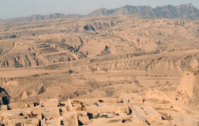
China is the most populous and possibly one of the most diverse nations on the planet, with a population of over 1.3 billion people and 56 ethnic groups.
What each one of those people shares with the rest of the world, regardless of political, linguistic, economic, and existential differences, is the complete and utter dependence on the ability to find food. In China’s Loess Plateau, sustained generational farming had depleted the soil, leaving in its wake a textured landscape of dust. When winds came, the dust blew into cities, compromising air quality. In the rains, it washed down the valley, depositing more of the silt that gives the Yellow River its name. In 1995, scientists and engineers surveyed the land of the Loess Plateau in an attempt to determine what was causing the once fertile belt to be a thorn in the country’s. The results of their study led to an experiment in permaculture in China that offers hope to the world.
John D. Liu, Chinese American ecologist and documentary film-maker, documented the project in an award-winning film called Hope in a Changing Climate. In the film that Liu narrates, he reports that the first thing that the scientists discovered was a causal relationship between ecosystem destruction and human poverty. Where environmental degradation is severe, the population becomes trapped in a downward spiral. Because they needed to eat to survive, generational subsistence farming had stripped the land bare in the Loess Plateau. In search of food for themselves and their flocks, farmers and their families continued to deplete the fertility of the surrounding ecosystem, further impoverishing themselves.
When scientists developed the plan to restore the ecosystem in China’s Loess Plateau, generational farmers had to be convinced that not farming was critical for their families’ long-term survival. To get buy in from the locals who did not understand how their families would eat if they were not allowed to farm, the government subsidized them and taught them how to do the work that would restore their land from a scarce dirt pit to a thriving ecosystem.
Around the world, populations are living a scarce subsistence lifestyle similar to the one that the citizens of China’s Loess Plateau used to live. The United Nations High Commissioner for Refugees (UNHCR) states that besides fleeing for personal safety, the basic need for food and shelter is the primary motivation for people leaving their homes and becoming displaced. If there were a stable food supply and supportive ecosystem, then the motivation for the world’s most vulnerable populations to move, would decrease. The UNHCR reports that competition for scarce resources triggers violence. If there were a way to restore resources so that people had food and a sense of power in their lives, the fuel for much of the world’s violence would be spent.
The permaculture experiment in China indeed offers hope to the world. Working with scientists, the local population terraced slopes, they planted trees, and they penned their herds so that the trees could grow without being eaten. Soon they found that their hillsides were green. Instead of letting the rains sheet off the mountains, the terraces collected the water and fed the delicate new roots systems, transforming the arid land into a booming garden. Liu reports that since he first visited the area in 1995, the people have seen a threefold increase in income and a profound sense of hope and empowerment. More