

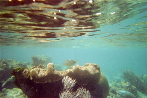
 This April 6, 2005 file photo shows a coral reef and fish on a snorkeling trail off Buck Island near St. Croix, U.S. Virgin Islands. U.S. scientists on Tuesday, April 7, 2015 completed a nearly two-week mission to explore waters around the U.S. Virgin Islands as part of a 12-year project to map the Caribbean sea floor and help protect its reefs. (AP Photo/Brent Hoffman, File)
U.S. scientists on Tuesday completed a nearly two-week mission to explore waters around the U.S. Virgin Islands as part of a 12-year project to map the Caribbean seafloor and help protect its reefs.
A team with the National Oceanic and Atmospheric Administration studied an area of 270 square miles (700 square kilometers), using equipment including underwater gliders and a remotely operated vehicle to help map the seafloor and locate areas where fish spawn. They focused mostly on the southern coast of St. Croix and…
View original post 256 more words
